
Visualise your location history as a heatmap in Google Maps API!
Upon checking my old blogs, I realised that Google Fusion Tables is going to be decommissioned in December of 2019. A difficult thing about using web services is that they aren’t very permanent! As a result, I thought I’d relook at an old project about displaying your Location History as a heat map but this time convert it to use the Google Maps API instead.
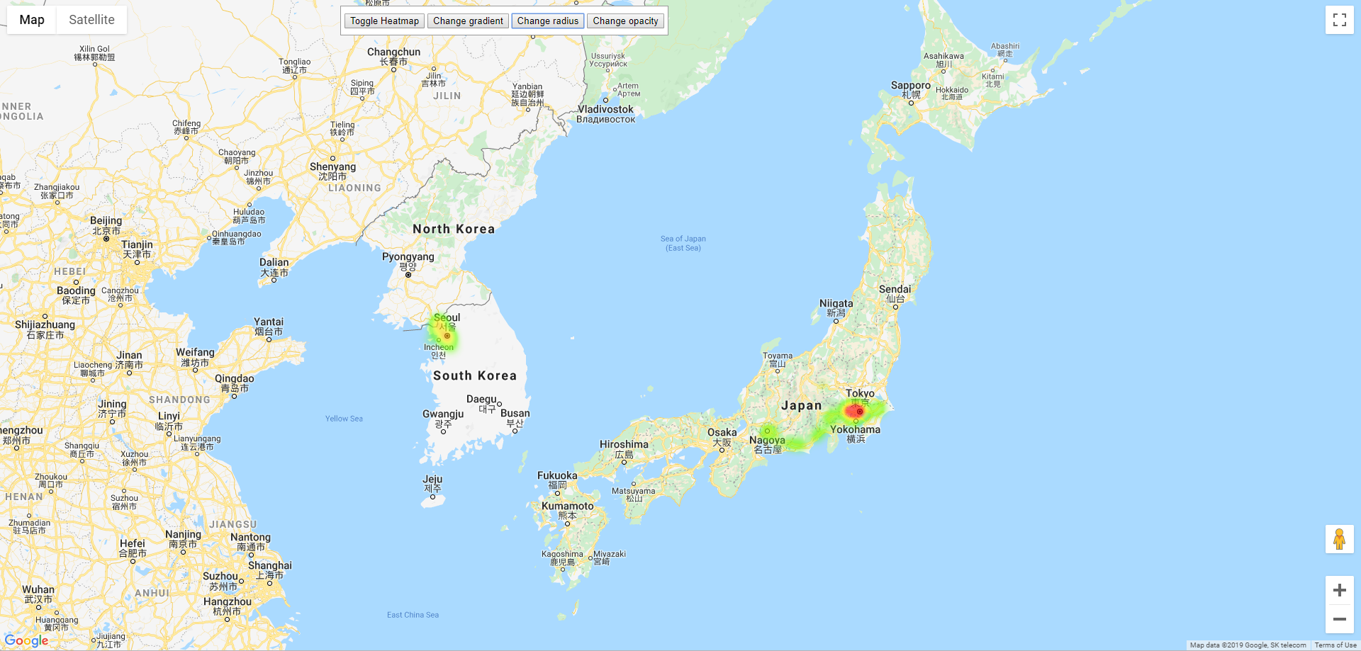
During my holiday to Korea and Japan I enabled “Google Location History” which is now called “Google Timeline” so that I could visually see where I was going during my trip. When I returned home, I downloaded the data and using a python script I made to analyse and try to remove duplicates (locations less than 5 kms to each other) and format it to a CSV file. I was able to import it to Google Fusion Tables and get a heatmap automatically.
I think the most interesting part is seeing the really strong splotch from Tachikawa to Yotsuya in Tokyo, (my daily commute) and that little splotch at the North Korean border when I took the tour to Panmunjom!
Although it’s a little intrusive for privacy, I think visualising trips this way is fascinating! You may download KML files of your own timeline and try to format it to the Google Maps API yourself!
Look here: https://github.com/rhysmcg/heatmaphistory